| Item Number: | 5071 |
| Year: | 1880 |
| City of edition: | Bruxelles |
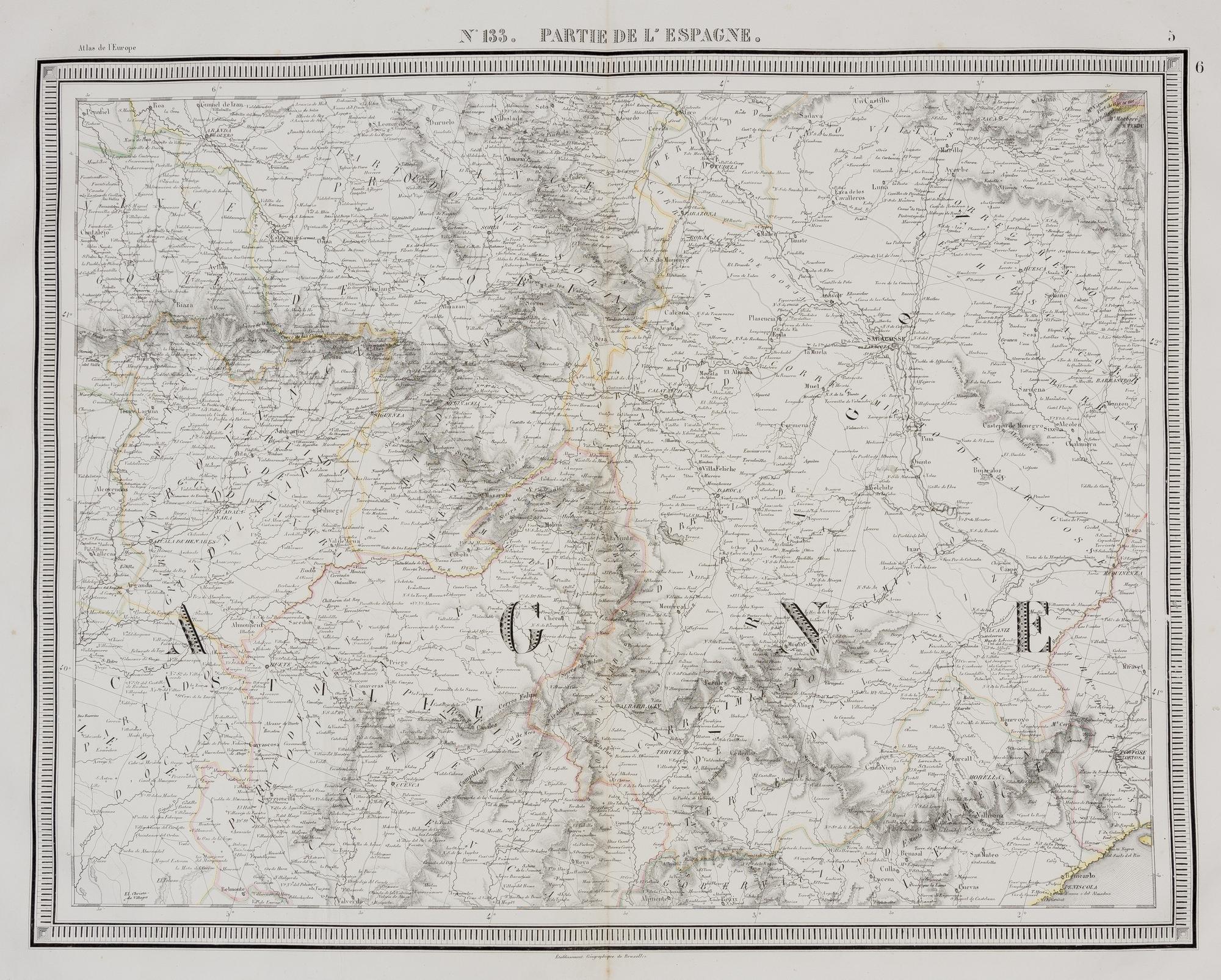
[Mapa antiguo de España incluyendo Zaragoza, Cuenca y Peniscola] N°133. Partie de l'Espagne
Precioso mapa de Philippe Vandermaelen, de su Atlas de Europa, publicado en 1880 [fol. 133]. El mapa muestra zonas del territorio español que incluyen la provincia de Guadalajara, el partido de Medinacelli, Castilla, Aragón, el gobierno de Morella, la región de Valencia, el corregimiento de Tortosa, y las provincias de Oviedo y Soria, entre otras subdivisiones territoriales. Las divisiones territoriales están coloreadas a mano. El relieve y el paisaje están representados mediante sombreados y hachures. ------------------------------------------- A fine map by Philippe Vandermaelen, from his Atlas of Europe, published in 1880 [fol. 117]. His groundbreaking work as a cartographer led him to create the first maps of Europe and the world at the same scale. The map shows parts of Spain extracted from the Atlas of Europe. It highlights the western part of the Iberian Peninsula with Galicia, the provinces of Entre Douro and Minho, and the provinces of Zamora and Leon, among others. The territorial divisions are hand-coloured. The relief and landscape are represented by shading and hachures.
Sin Encuadernar - No binding
Good