| Item Number: | 13056 |
| Year: | c. 1631 |
| City of edition: | Amsterdam |
| Size: | 450 x 550 |
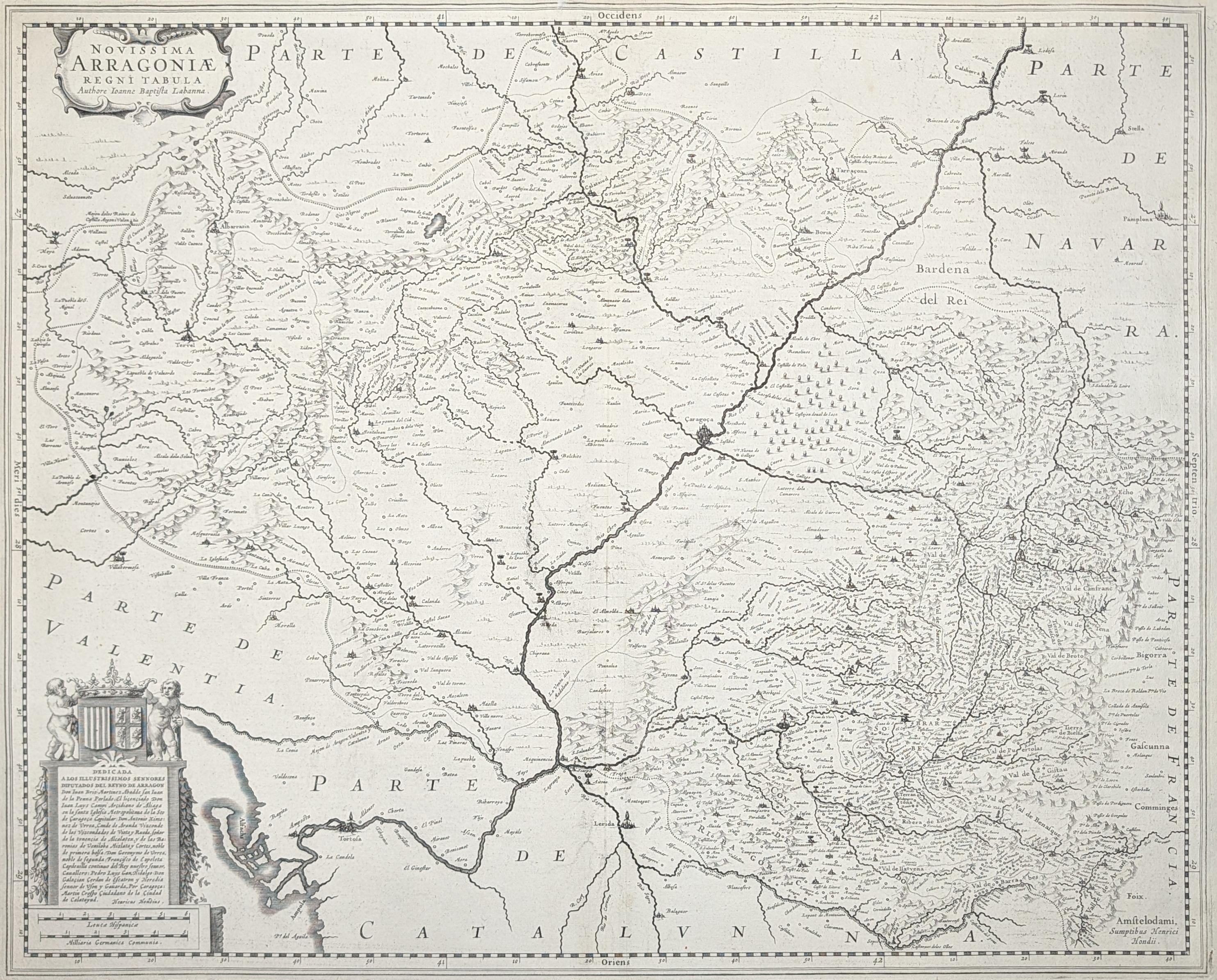
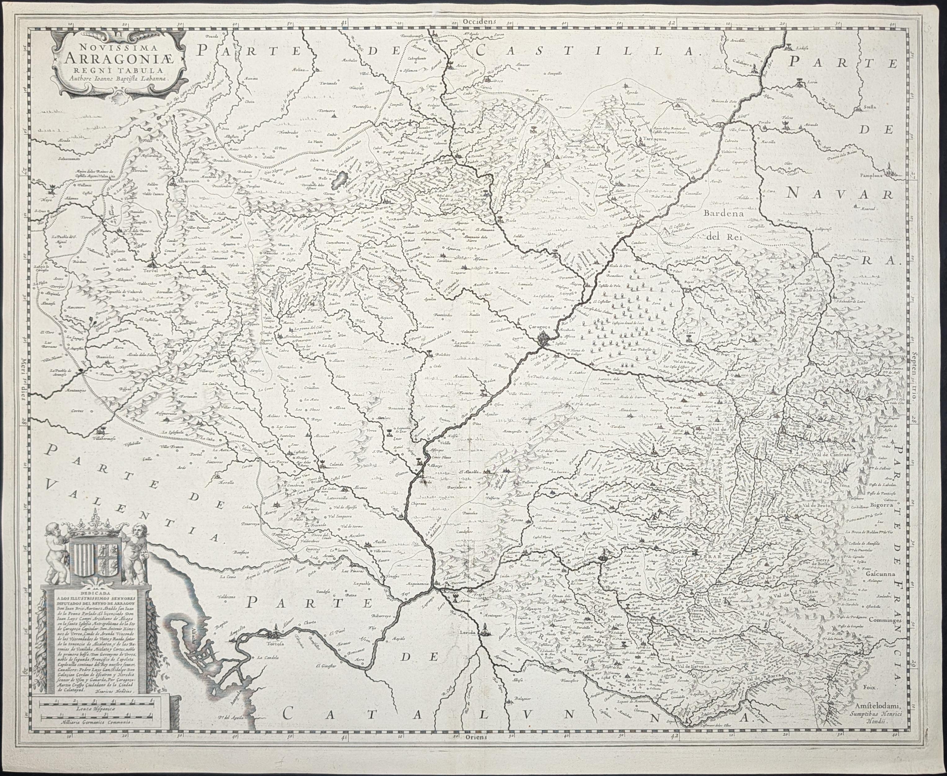
Novissima Arragoniae Regni Tabula [mapa de Arragón]
Mapa antiguo original del Reino de Aragón, grabado por Henricus Hondius y editado en Ámsterdam hacia 1631. Su título completo es "Novissima Arragoniae Regni Tabula" ("Mapa más reciente del Reino de Aragón"). El mapa representa el territorio histórico del Reino de Aragón, situado en el noreste de la península ibérica, limitando al norte con los Pirineos, al este con Cataluña y el Mediterráneo, al sur con Valencia y al oeste con Castilla y Navarra. Se encuentra orientado al occidente. Se puede apreciar el río Ebro, desde Tortosa hasta Zaragoza y Calahorra.
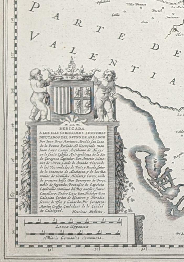
Las principales ciudades, como Teruel, Calatayud, Monzón, Barbastro y Alcañiz, están señaladas por varios campanillos y símbolos, en función de su importancia. En la parte inferior izquierda, el autor dedica el mapa a los "ilustrísimos señores diputados del Reino de Aragón", a quienes nombra.
Durante el siglo XVII, el Reino de Aragón formaba parte de la Corona de Aragón, que junto con Castilla conformaba la monarquía hispánica. Henricus Hondius (1597-1651) fue un cartógrafo y editor holandés establecido en Ámsterdam, hijo de Jodocus Hondius, quien continuó el trabajo editorial de su padre publicando atlas y mapas de gran difusión en Europa. Descripción del Aragón y de Cataluña al verso, en francés. Grabado en cobre, en negro.
--------------------
Original antique map of the Kingdom of Aragon, engraved by Henricus Hondius and published in Amsterdam around 1631. Its full title is "Novissima Arragoniae Regni Tabula" ("Most Recent Map of the Kingdom of Aragon"). The map represents the historic territory of the Kingdom of Aragon, located in the northeast of the Iberian Peninsula, bordered to the north by the Pyrenees, to the east by Catalonia and the Mediterranean, to the south by Valencia, and to the west by Castile and Navarre. It is oriented to the west. The Ebro River can be seen, from Tortosa to Zaragoza and Calahorra.
The main cities, such as Teruel, Calatayud, Monzón, Barbastro, and Alcañiz, are represented by various bells and symbols, according to their importance. In the lower left part, the author dedicates the map to the "most illustrious gentlemen deputies of the Kingdom of Aragon", whom he names.
During the 17th century, the Kingdom of Aragon was part of the Crown of Aragon, which together with Castile formed the Hispanic monarchy. Henricus Hondius (1597-1651) was a Dutch cartographer and publisher established in Amsterdam, son of Jodocus Hondius, who continued his father's publishing work by producing atlases and maps widely distributed in Europe. Description of Aragon and Catalonia on the verso, in French. Copper engraving, in black.
Ligero desgaste en el antiguo doblez, buen estado general.