| Item Number: | 13041 |
| Year: | 1811 |
| City of edition: | Weimar |
| Size: | 295 x 400 |
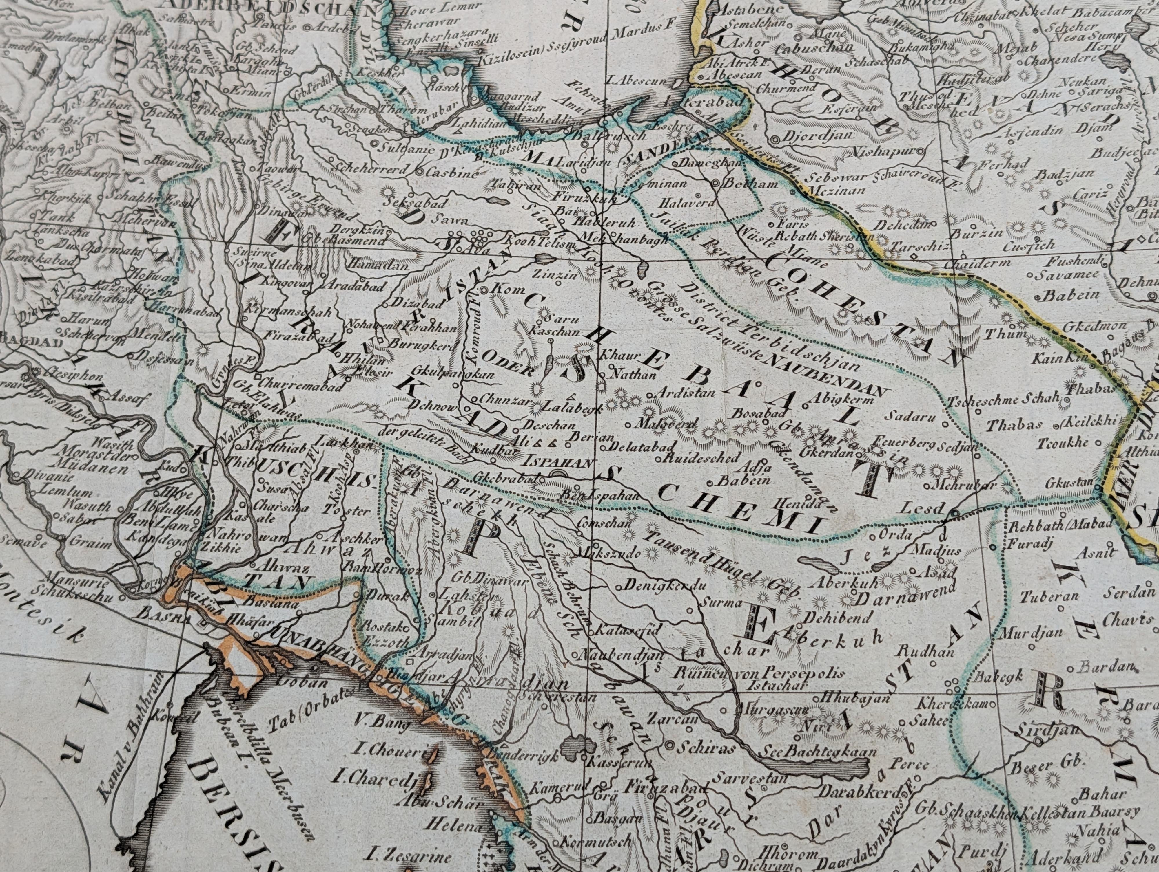
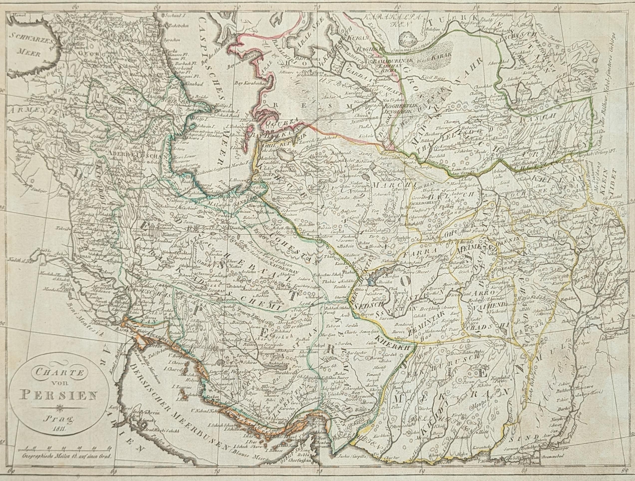
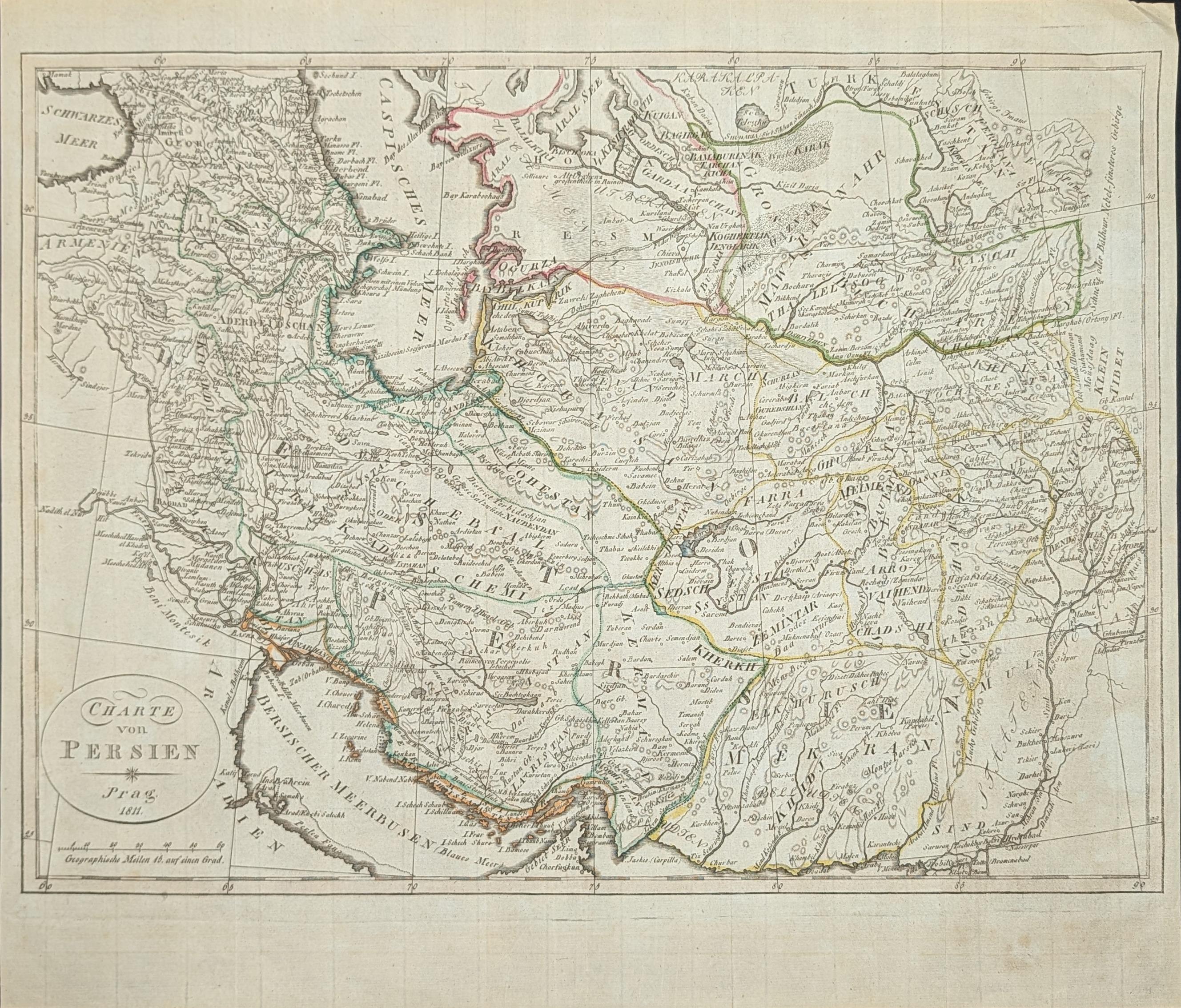
Charte von Persien
Mapa antiguo original de Persia, grabado por Theophil Friedrich Ehrmann y editado en Weimar en 1811. El mapa representa el territorio de Persia, que corresponde al actual Irán y sus regiones circundantes. Abarca las principales ciudades, rutas y accidentes geográficos de la zona. El mapa fue publicado en el contexto de las exploraciones y estudios geográficos europeos sobre Asia occidental a principios del siglo XIX, cuando las potencias europeas buscaban cartografiar con mayor precisión los territorios que conectaban Europa con Asia. Theophil Friedrich Ehrmann fue un geógrafo y editor alemán activo a finales del siglo XVIII y principios del XIX, conocido por sus atlas y obras geográficas que difundían el conocimiento territorial de diversas regiones del mundo. El mapa está realizado mediante grabado en cobre.
--------------------
Original antique map of Persia, engraved by Theophil Friedrich Ehrmann and published in Weimar in 1811. The map depicts the territory of Persia, corresponding to present-day Iran and its surrounding regions. It covers the main cities, routes and geographical features of the area. The map was published in the context of European explorations and geographical studies of Western Asia in the early nineteenth century, when European powers sought to map with greater precision the territories connecting Europe and Asia. Theophil Friedrich Ehrmann was a German geographer and publisher active in the late eighteenth and early nineteenth centuries, known for his atlases and geographical works that disseminated territorial knowledge of various regions of the world. The map is made by copper engraving.
Evidencia de antiguos dobleces. Sello de un antiguo museo municipal de Bohemia al reverso (Městské Teplice-Š Museum). Muy buen estado de conservación.