| Item Number: | 13005 |
| Year: | 1649 |
| City of edition: | Turin |
| Size: | 27 x 37.3 |
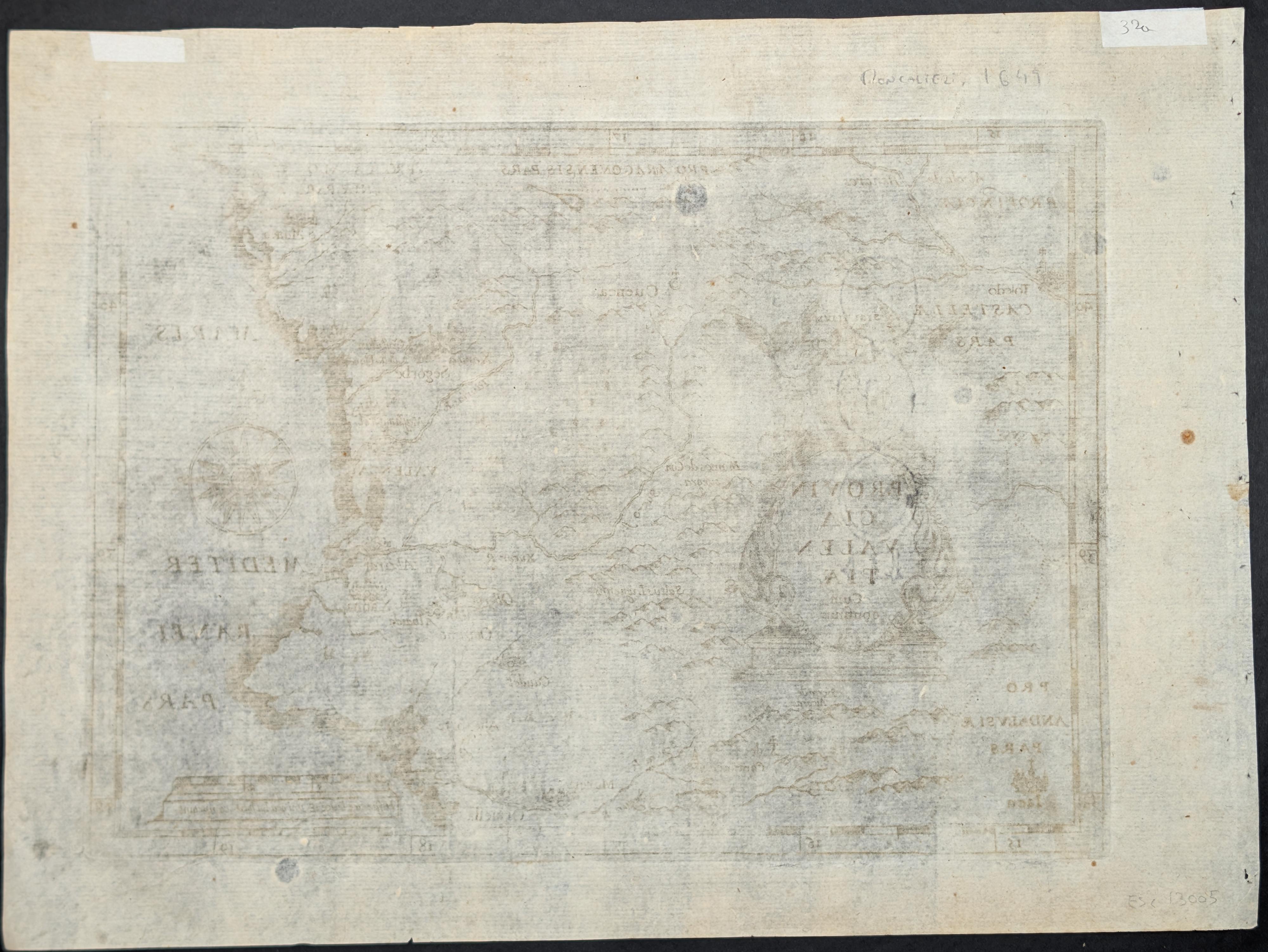
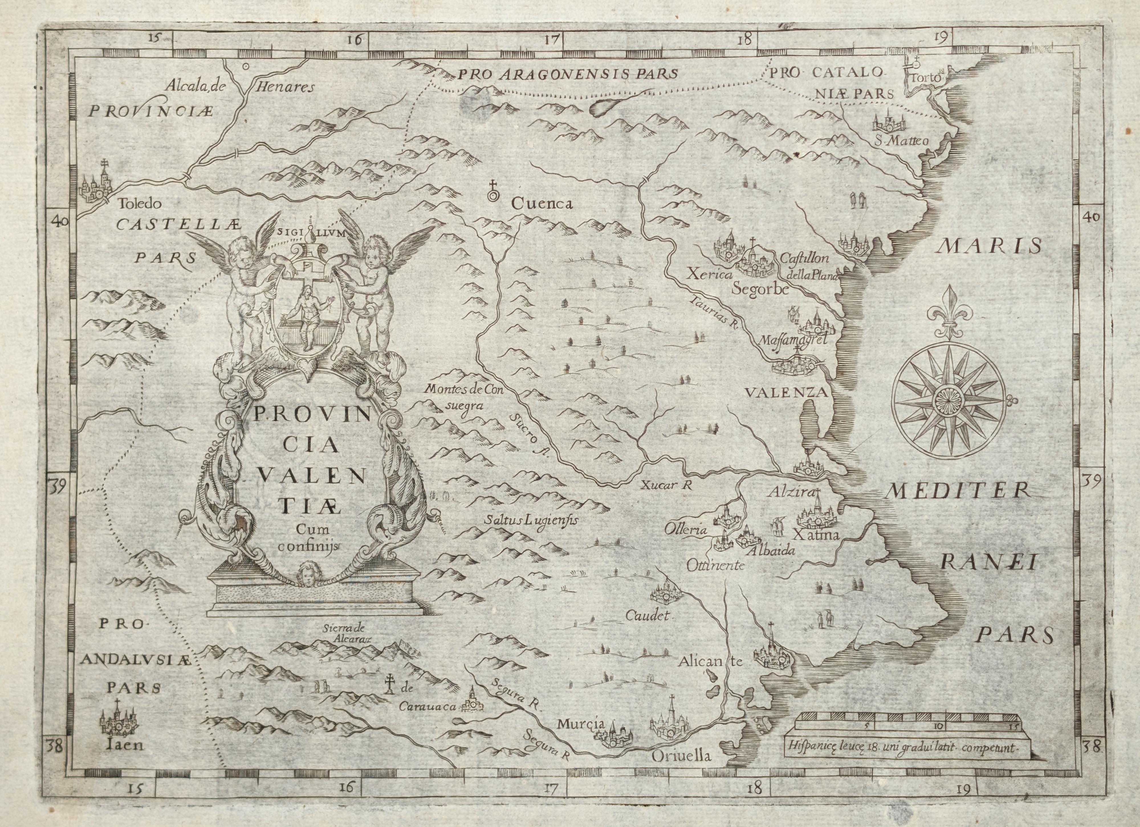
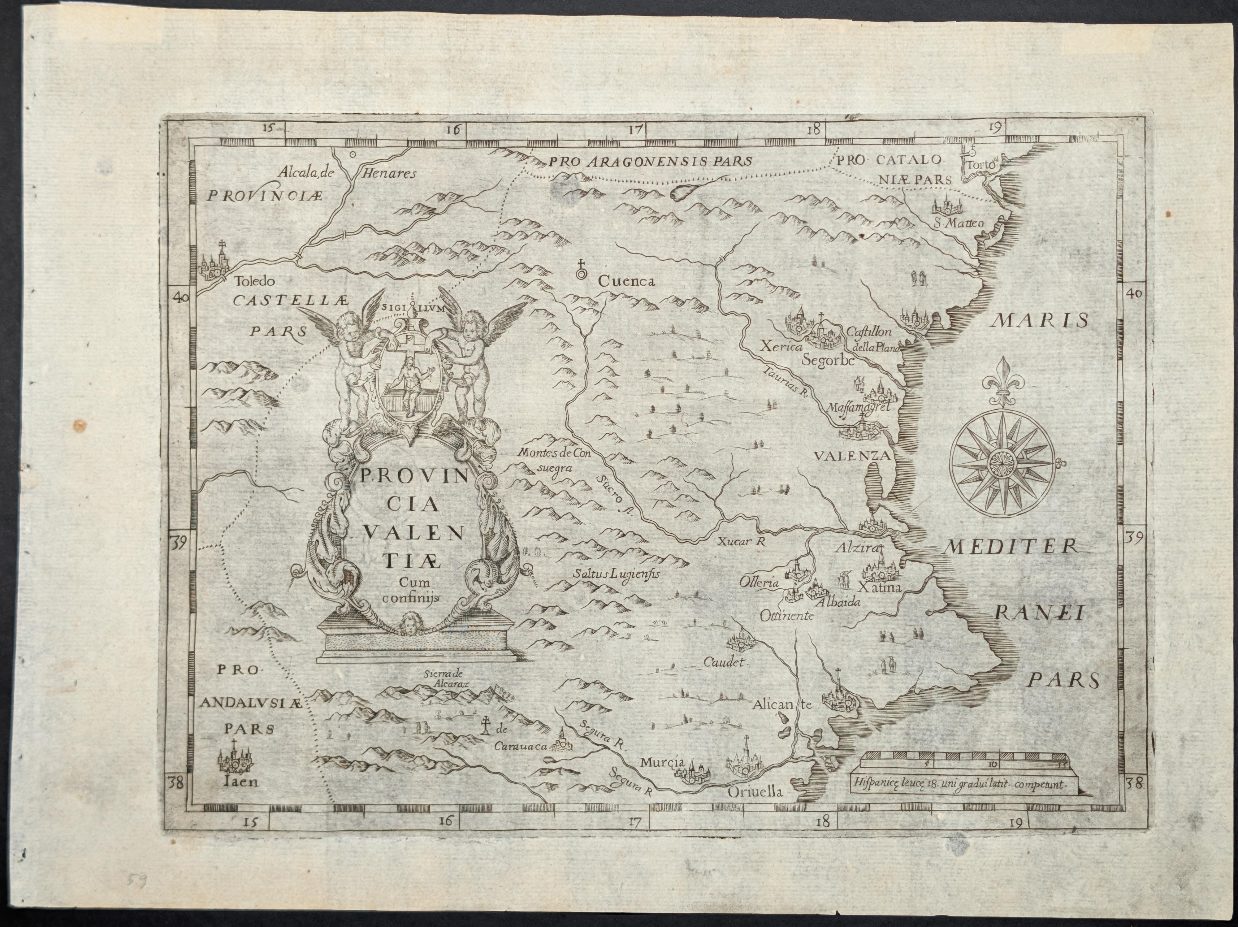
Provincia Valentiae cum confinijs [Mapa de la provincia de Valencia]
Mapa antiguo original de la provincia capuchina de Valencia y sus regiones vecinas, elaborado por Giovanni da Moncalieri en 1649. Este mapa fue publicado en Turín por Giovanni de Moncalieri, un monje capuchino al servicio de la casa de Saboya.
La representación cartográfica abarca la provincia de Valencia y las zonas limítrofes, incluyendo referencias a Cuenca, Murcia, Alicante y Castellón de la Plana. El título aparece en latín: "Provincia Valentiae cum confinijs". El mapa muestra la configuración territorial de la región valenciana en el siglo XVII, con indicaciones de ciudades, poblaciones y divisiones territoriales.
El documento presenta la provincia capuchina de Valencia, señalando los lugares donde estaban presentes los capuchinos: conventos, iglesias y seminarios. Esta información refleja la red de establecimientos religiosos de la orden en el territorio valenciano durante el periodo barroco.
Giovanni da Moncalieri realizó varios trabajos cartográficos durante su labor como religioso vinculado a la corte saboyana. La impresión mide 27 x 37,3 centímetros.
--------------------
Original antique map of the province of Valencia and its neighboring regions, produced by Giovanni da Moncalieri in 1649. This map was published in Turin by Giovanni de Moncalieri, a Capuchin monk in the service of the House of Savoy.
The cartographic representation covers the province of Valencia and the bordering areas, including references to Cuenca, Murcia, Alicante and Castellón de la Plana. The title appears in Latin: "Provincia Valentiae cum confinijs". The map shows the territorial configuration of the Valencian region in the 17th century, with indications of cities, towns and territorial divisions.
The document presents the Capuchin province of Valencia, marking the places where the Capuchins were present: convents, churches and seminaries. This information reflects the network of religious establishments of the order in the Valencian territory during the Baroque period.
Giovanni da Moncalieri produced several cartographic works during his service as a religious figure linked to the Savoyard court. The print measures 27 x 37.3 centimeters.
Excelente estado de conservación.