| Referencia: | 4348 |
| Año: | 1695 |
| Lugar de edición: | Paris |
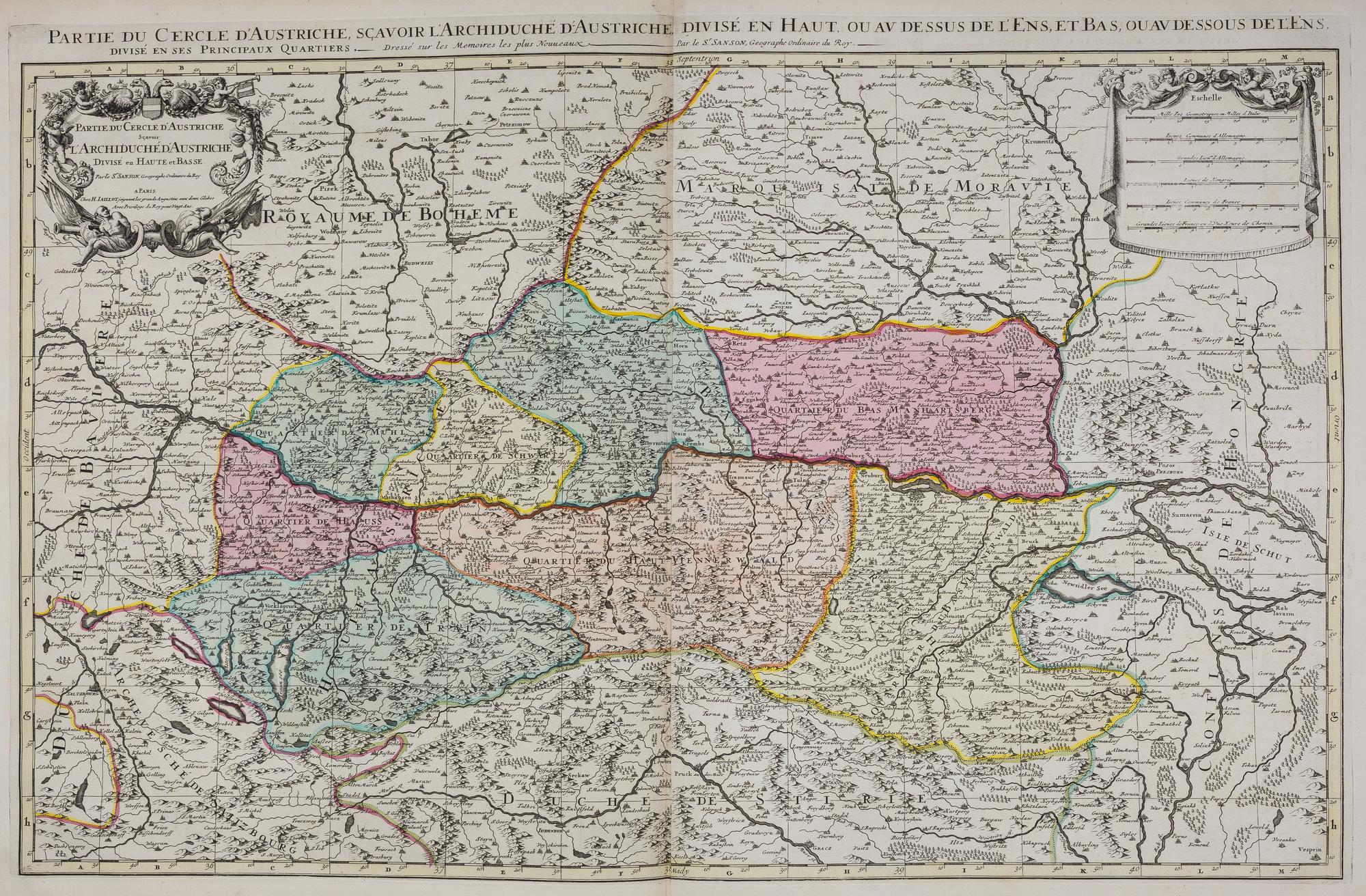
Partie du Cercle d'Austriche scavoir l'Archiduché d'Austriche. . . [Antique wall map of Austria, Czech Republic, Germany and Hungary]
C. 1695. Large-format antique map covering the present-day territories of Austria, Czech Republic, Germany, and Hungary, also depicting the course of the Danube. Edited in Paris by Hubert Jaillot, the title cartouche symbolizes the victory over the Ottoman Empire in the Battle of Vienna with a four-headed eagle and two Turkish prisoners at the bottom. This original map was created by Nicolas Sanson (1600-1667), the most important French cartographer of the 17th century. He is even considered the father of the French school of cartography during its golden age, spanning from the mid-17th century to the mid-18th century. He began making maps in the 1620s and by the following decade was already collaborating with Melchior Tavernier. Later, Sanson worked with the publisher Pierre Mariette, with whom he published his great atlas Cartes générales de toutes les parties du monde (1658). Throughout his career, he produced over 300 maps, and upon his death in 1667, his son Guillaume continued the cartographic business in partnership with Alexis Hubert Jaillot, also becoming a renowned cartographer. -------------- ---------------------------------- ---------------------- -------------------- c. 1695. Mapa antiguo de gran formato que abarca los territorios actuales de Austria, República Checa, Alemania y Hungría, y muestra también el curso del Danubio. Editado en París por Hubert Jaillot, el cartouche del título representa la victoria sobre el Imperio Otomano en la batalla de Viena por medio de un águila bicéfala cuatro puti y dos prisioneros turcos en la parte inferior. Este mapa original fue realizado por Nicolas Sanson (1600-1667), el cartógrafo francés más importante del siglo XVII. Incluso es considerado el padre de la escuela francesa de cartografía en su época dorada, que abarcó de mediados del siglo XVII a mediados del siglo XVIII. Comenzó a hacer mapas en la década de 1620 y en el decenio siguiente ya trabajaba con Melchior Tavernier. Más tarde, Sanson trabajó con el editor Pierre Mariette, con quien publicó su gran atlas Cartes générales de toutes les parties du monde (1658). A lo largo de su carrera produjo más de 300 mapas y a su muerte, ocurrida en 1667, su hijo Guillaume continuó con el negocio cartográfico en sociedad con Alexis Hubert Jaillot, convirtiéndose también en un reconocido cartógrafo. 56 x 86 cm. Aternate title: Partie du Cercle d'Autriche savoir l'Archiduché d'Autriche.
Sin Encuadernar
Very good