| Referencia: | 10828 |
| Editorial: | Impr. Dr. C. Wolf & Fils |
| Año: | 1910 |
| Lugar de edición: | Munich / Cairo |
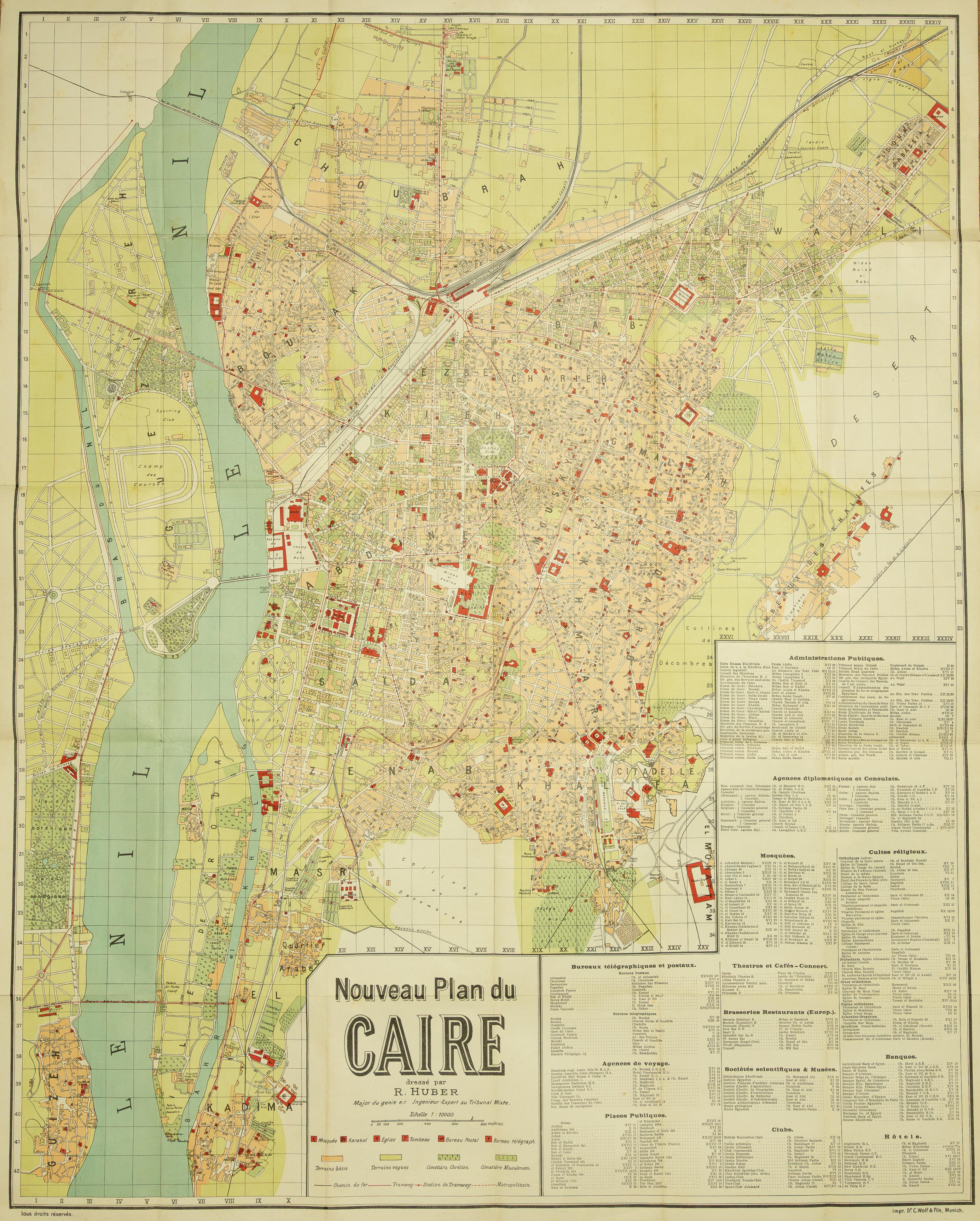
Le Caire [Antique Plan of Cairo, Egypt]
Extremely rare plan of Cairo, published in Munich circa 1910–1911. Little is known about the author, Rodolphe Huber. He is listed with various military titles and as an engineer on his maps, suggesting training as a military engineer. Huber produced several important maps of Egypt and the Near East:
• [Istanbul] Plan de Galata, Péra, Taxim, Pankaldi et Ferikeny (location unknown, 1895)
• Carte de la Province du Liban (Munich, 1905)
• Empire Ottoman. Division Administrative (Paris, 1907)
• Empire Ottoman : carte statistique des cultes chrétiens (published by Baader & Gross, Cairo, 1911)
His first plan of Cairo appeared in 1908 under the title “Plan du Caire,” printed in Munich for the Cairo-based bookseller F. Diemer, Finck & Baylaender successeurs. This large map (176 × 142 cm) is known from a single surviving example in the Bibliothèque nationale de France (BnF).
A few years later, Huber released a revised version: “Nouveau Plan du Caire.” This edition, offered here, measures 88 × 70 cm and was likely produced at a lower cost. Printed again in Germany, the plan was intended for sale in Egypt—the cover states: “Prix : 20 P. T.” (Price: 20 Turkish Piastres). At that time, the Turkish piastre was the currency in Egypt: 100 piastres equalled one Egyptian pound, since Egypt remained within the Ottoman Empire in 1911.
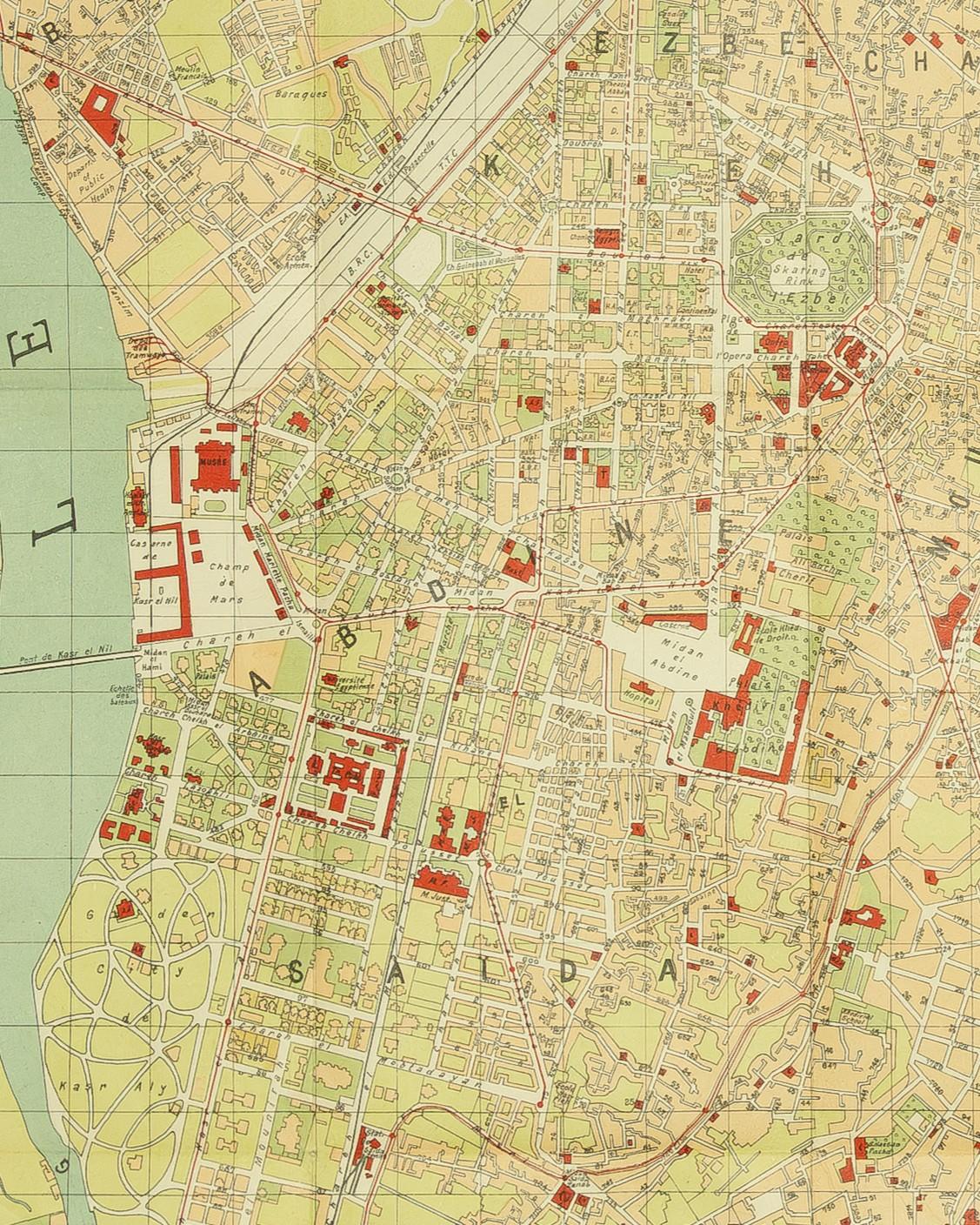
The “Nouveau Plan du Caire” is not a simple reduction of the 1908 map. While the city center shows few changes, significant updates appear in outlying neighborhoods, especially Shubra. The eastern section of Dokki indicates the beginnings of organized urban development, although publication coincided with the bankruptcy of the company responsible for that district.
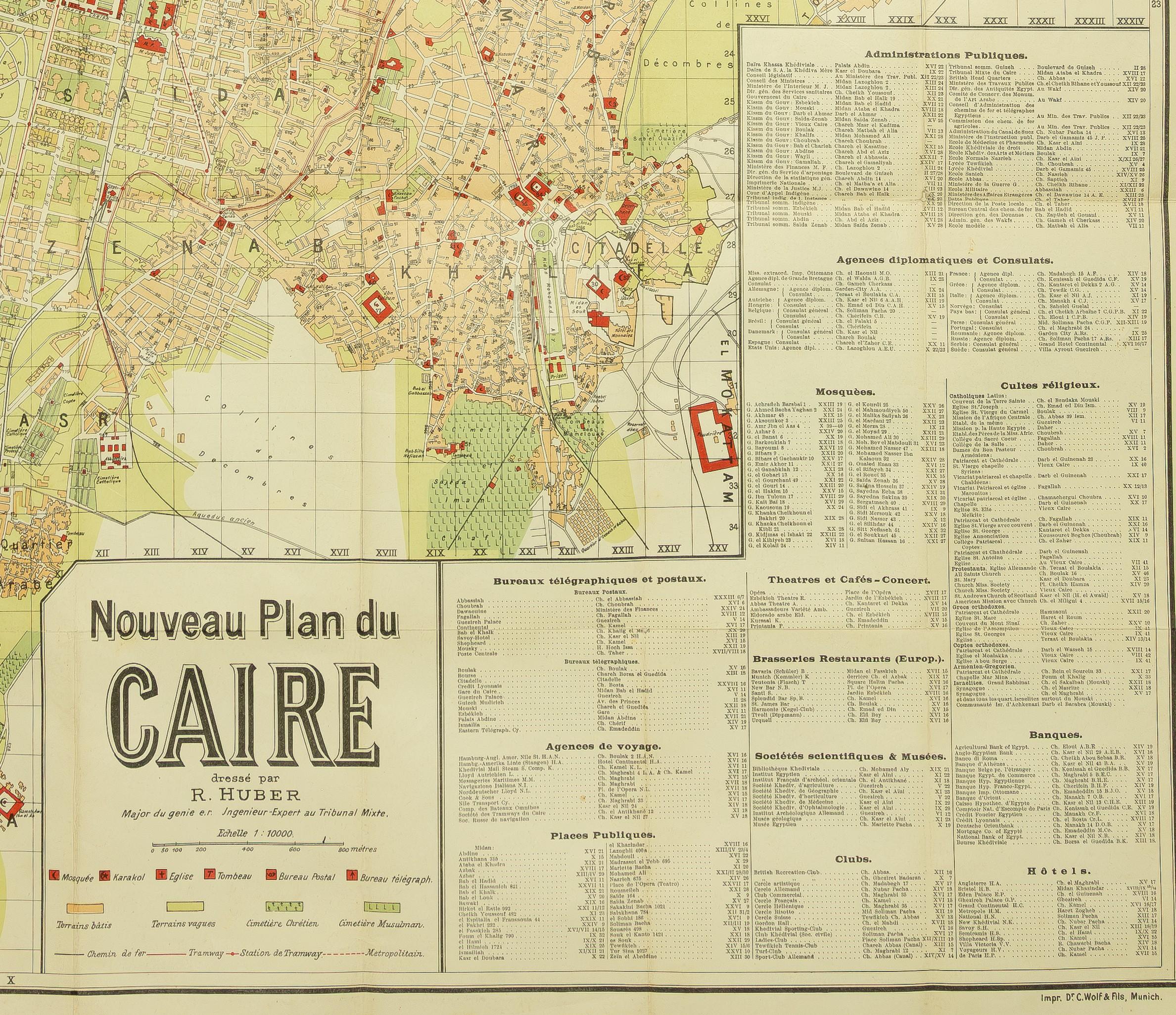
The lower right features a large, sectioned legend that reflects the map’s intended audience: public administrations, embassies and consulates, mosques and other places of worship, post and telegraph offices, theaters and cafés, etc. Additional legends beneath the title detail mosques, police stations (“karakol”), churches, post and telegraph offices, as well as railway and trolleybus lines, including the “metropolitain”—the electric railway connecting Cairo to Heliopolis (Miṣr al-Jadīda).
Rarity:
WorldCat/OCLC records only one copy of this plan, in the National Library of Sweden. Owing to its scarcity, it appears in just a single scholarly publication. No copies have surfaced in the antiquarian or auction market over the past sixty years.