| Referencia: | 13043 |
| Año: | 1791 |
| Lugar de edición: | Viena |
| Medidas: | 209 x 284 |
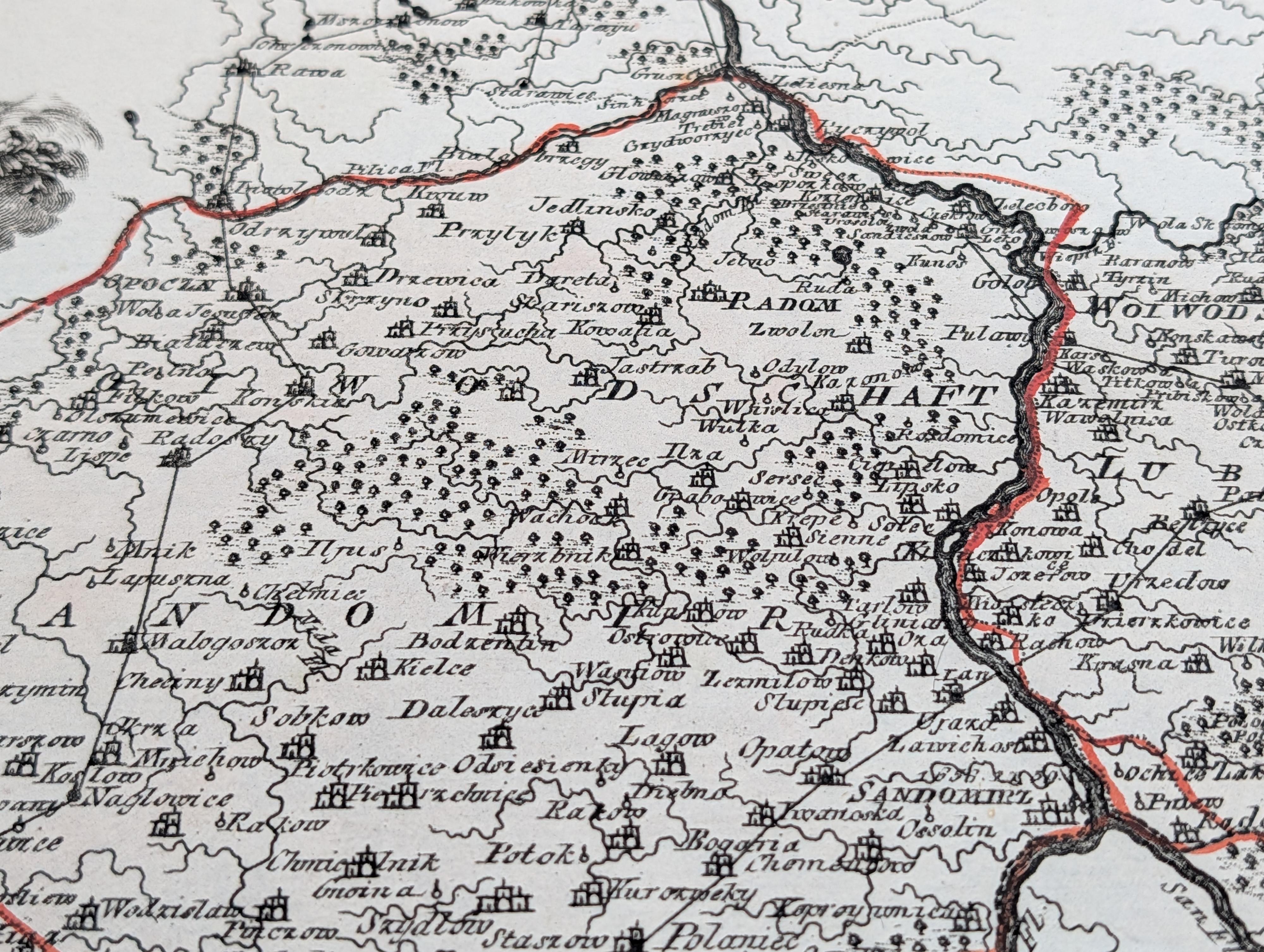
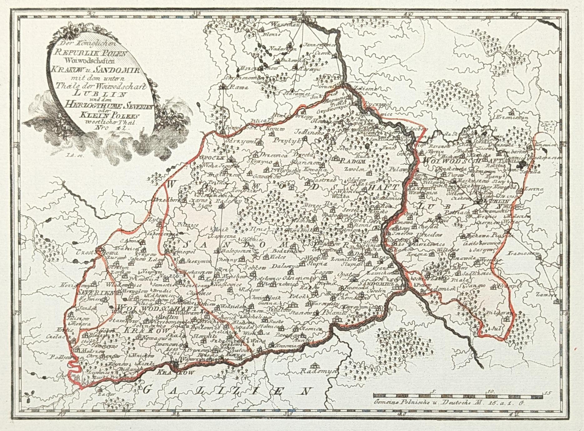
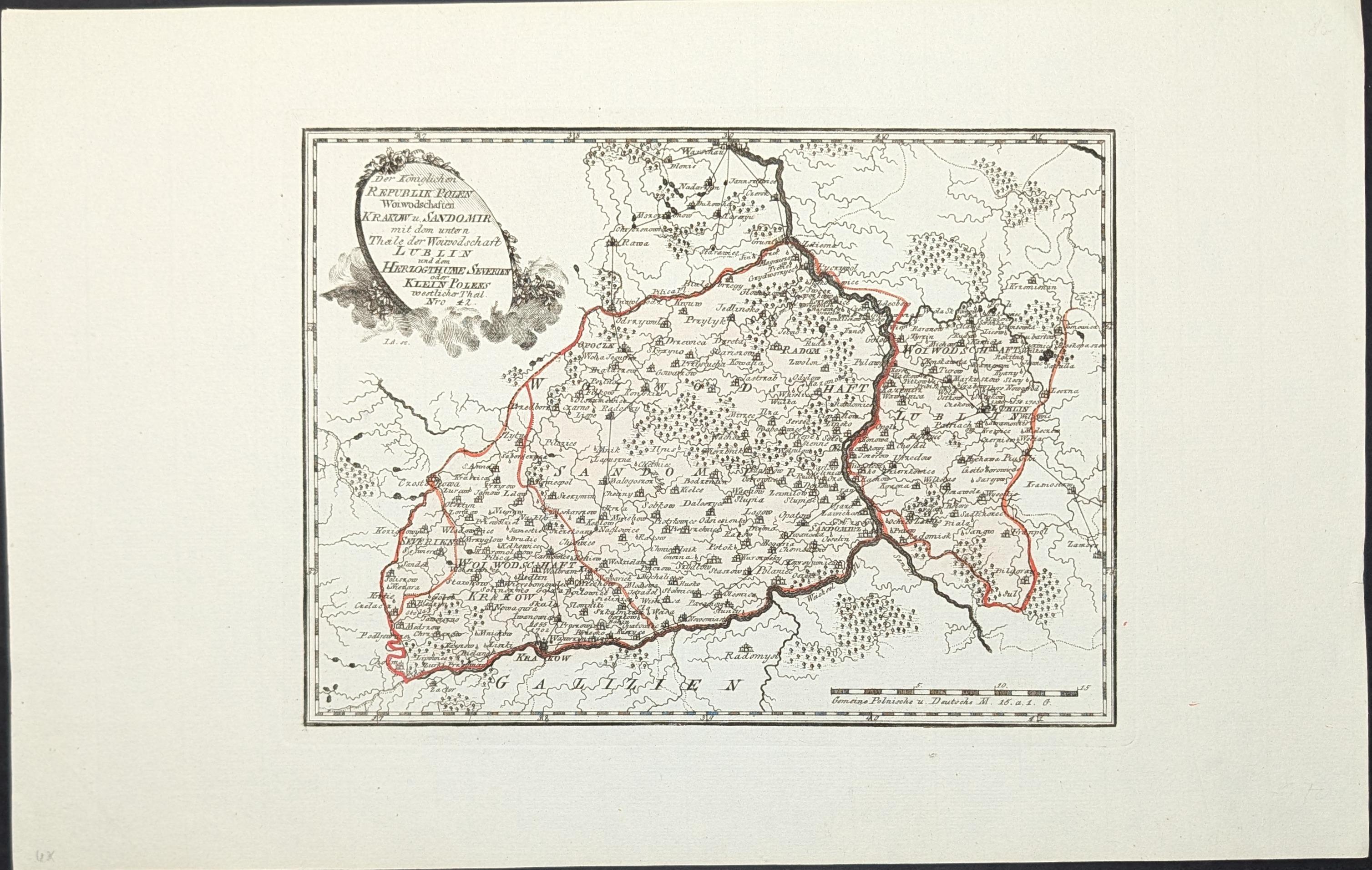
Der Königlichen Republik Polen Woiwodschaften Krakow u. Sandomir
Mapa antiguo original de los voivodatos (palatinado) de Cracovia y Sandomierz, en el sur de la República de Polonia, grabado por Franz Johann Joseph von Reilly y editado en Viena en 1791. El mapa representa dos de las principales divisiones administrativas de Polonia a finales del siglo XVIII, situadas en la región central del país. El voivodato de Cracovia incluía la ciudad de Cracovia, antigua capital real y centro político y cultural. El voivodato de Sandomierz se extendía al este, a lo largo del curso del Vístula. En 1791, Polonia atravesaba un periodo crítico de su historia: ese mismo año se promulgó la Constitución del 3 de mayo, un intento de reforma para salvar la independencia del país, que sería dividido entre Rusia, Prusia y Austria dos años más tarde en la segunda partición. Franz Johann Joseph von Reilly fue un cartógrafo y editor austriaco activo en Viena entre 1760 y 1820. Publicó un gran atlas geográfico en varios volúmenes que cubría todas las regiones de Europa. Grabado en cobre.
--------------------
Original antique map of the voivodeships of Cracow and Sandomierz, in southern Poland, engraved by Franz Johann Joseph von Reilly and published in Vienna in 1791. The map depicts two of the main administrative divisions of the Polish Republic in the late 18th century, located in the central region of the country. The voivodeship of Cracow included the city of Cracow, the former royal capital and a major political and cultural center. The voivodeship of Sandomierz extended to the east, along the course of the Vistula River. In 1791, Poland was going through a critical period: that same year, the Constitution of May 3 was enacted, an attempt to reform and preserve the country's independence, which would be partitioned between Russia, Prussia, and Austria two years later in the second partition. Franz Johann Joseph von Reilly was an Austrian cartographer and publisher active in Vienna between 1760 and 1820. He produced a major multi-volume geographical atlas covering all regions of Europe. Copper engraving.
Excelente estado de conservación.