| Referencia: | 5495 |
| Año: | 1779 |
| Lugar de edición: | Paris |
| Medidas: | 45,8x56,2 |
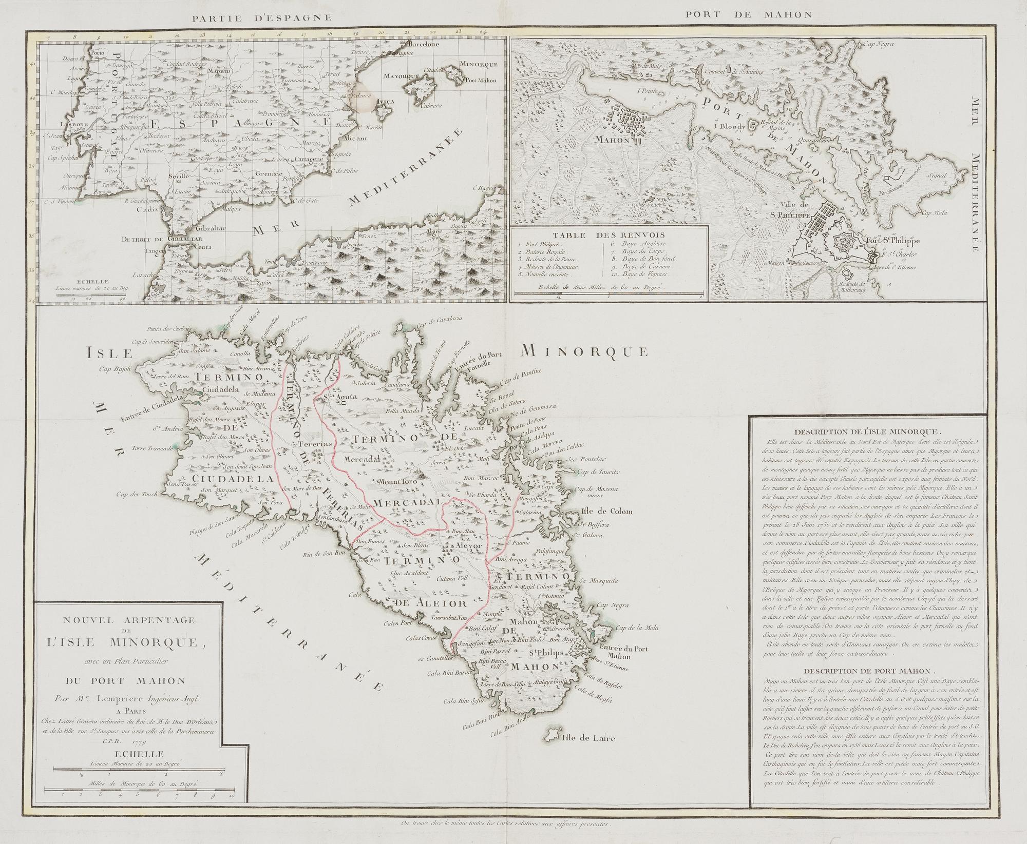
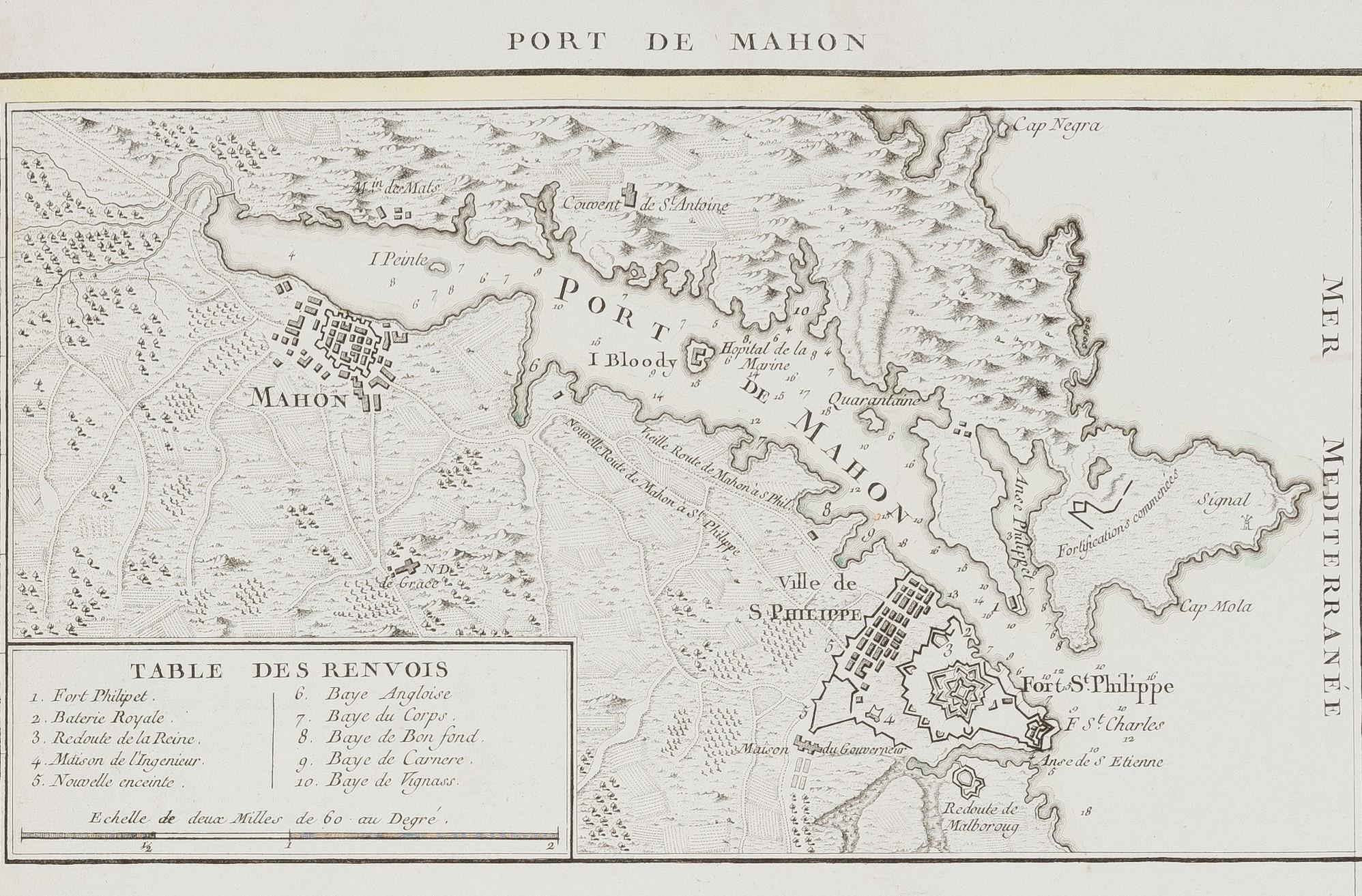
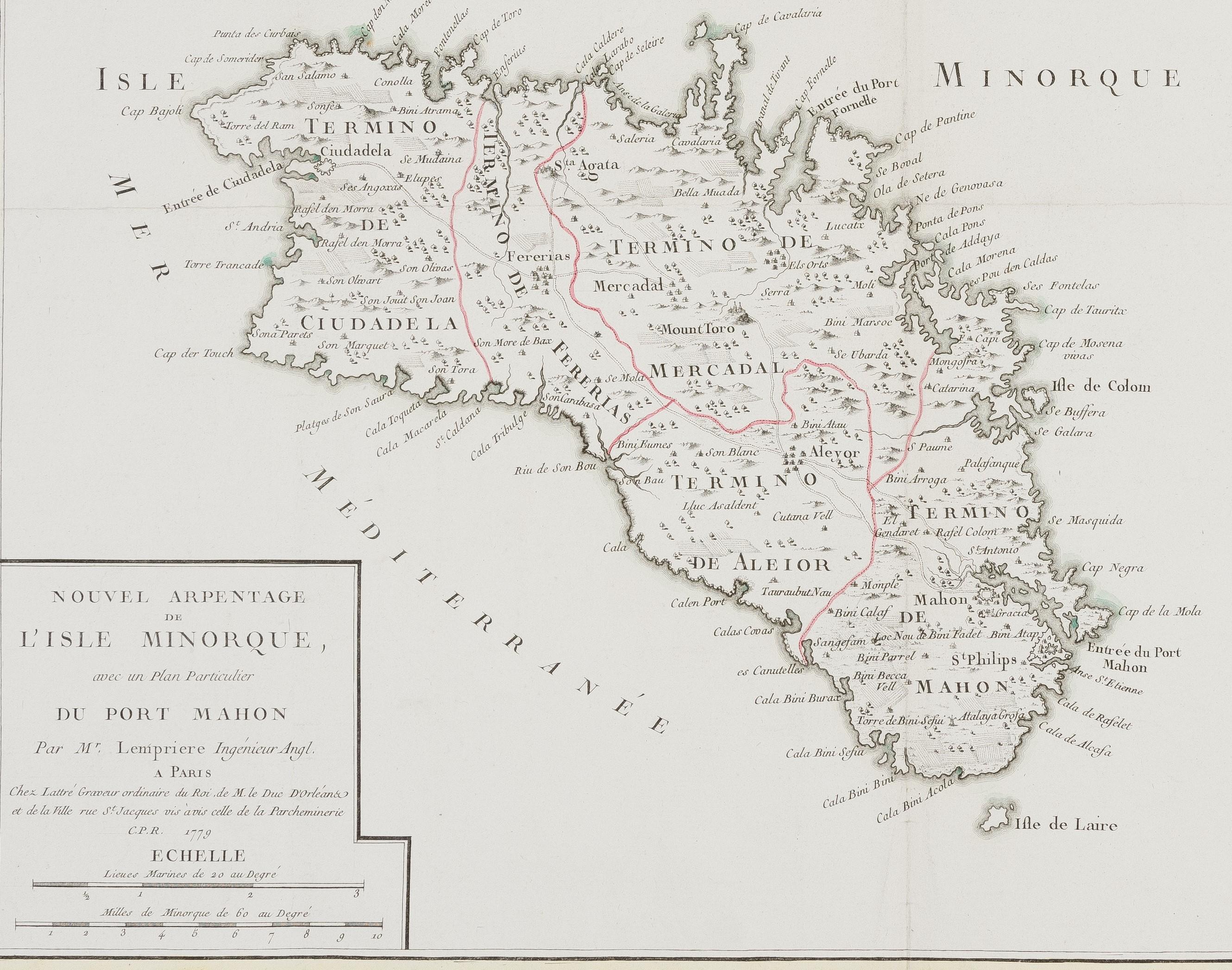
[Mapa] Nouvel arpentage de l'Isle Minorque avec un Plan particulier du Port Mahon [map of Minorca]
46 x 56 cm. Un gran mapa de la isla de Menorca dibujado por Lempriere, datado en 1779. Este mapa se compone de tres partes diferentes. En la parte inferior central se encuentra el propio mapa de Menorca, con subdivisiones territoriales resaltadas en rojo. A la izquierda, una cartela contiene el título del mapa y las escalas, mientras que a la derecha, otra cartela incluye la descripción de Menorca y Port Mahón en su costa oriental. En la parte superior izquierda, se muestra un mapa general de España, el norte de África y las Islas Baleares. En la parte superior derecha, una vista detallada de Port Mahón con su leyenda y escalas presenta las ciudades de Port Mahón y St. Philippe. Las características del relieve, zonas y campos arbolados, áreas habitadas y fortificaciones se representan de manera pictórica. ---------------------------------------- A large map of the island of Menorca by Lempriere, dated 1779. This map unfolds into three different parts. The central bottom part includes the map of Menorca itself, with territorial subdivisions in red; on the left is a cartouche including the map's title and scales and on the right, another cartouche, including the description of Menorca and Port Mahon on its eastern coast. A general map of Spain, North Africa, and the Balearic islands is displayed on the top left-hand side. On the top right-hand side, a close-up of Port Mahon with its legend and scales shows the cities of Port Mahon and St Philippe. Relief features, wooded areas and fields, inhabited areas, and fortifications are shown pictorially.
Sin Encuadernar - No binding
Good (bueno)