| Referencia: | 13069 |
| Año: | 1850 |
| Lugar de edición: | Paris |
| Medidas: | 495 x 385 |
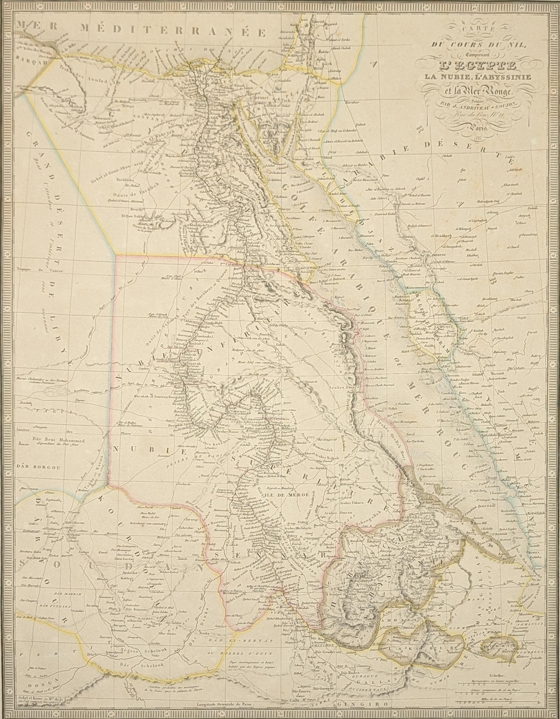
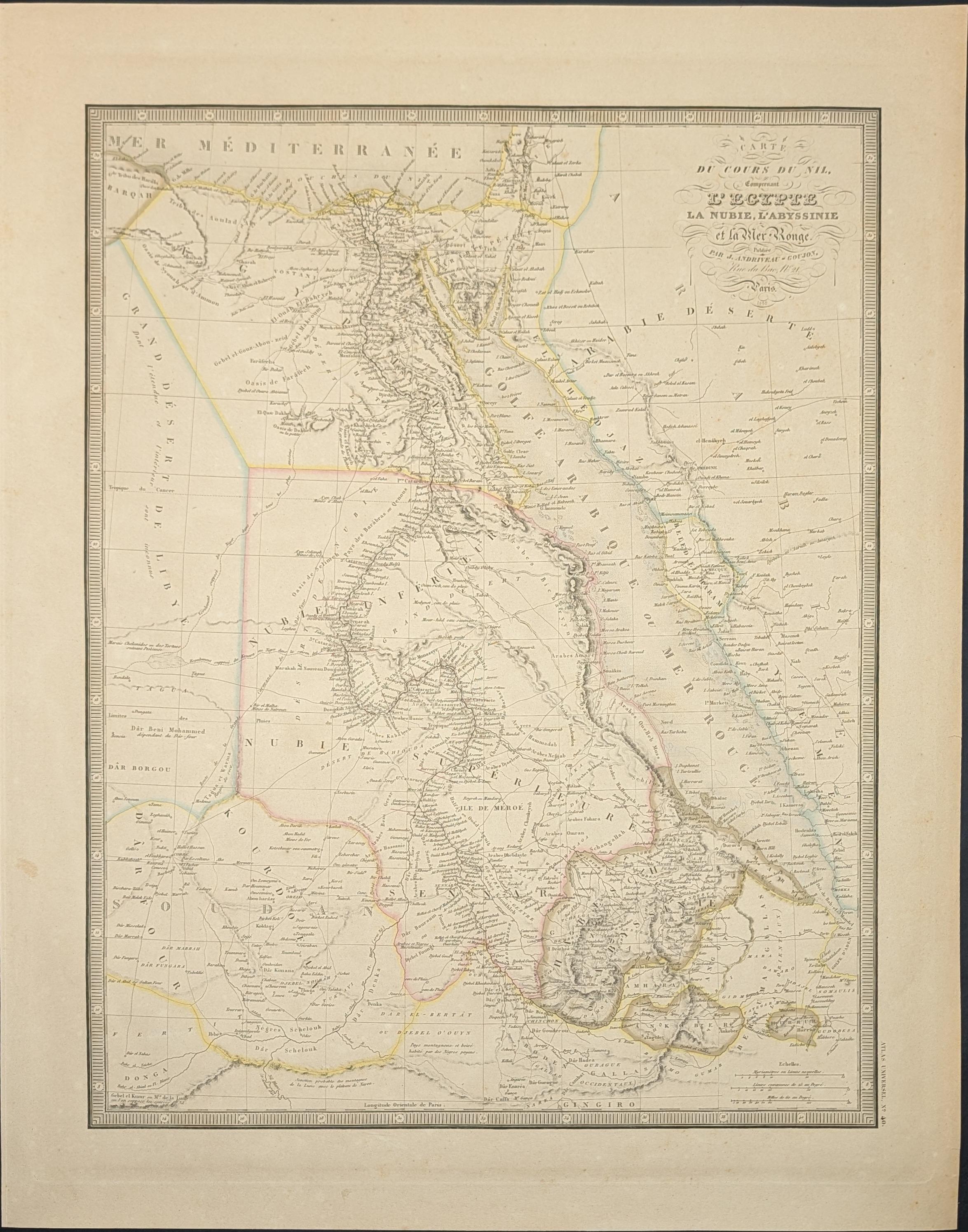
Carte du Cours du Nil comprenant l'Egypte, la Nubie, l'Abyssinie et la Mer Rouge
Mapa antiguo original del curso del río Nilo, que abarca Egipto, Nubia, Abisinia y el Mar Rojo, grabado por Jules Andriveau-Goujon y editado en París en 1850. El título completo del mapa es «Carte du Cours du Nil comprenant l'Egypte, la Nubie, l'Abyssinie et la Mer Rouge» (Mapa del curso del Nilo que comprende Egipto, Nubia, Abisinia y el Mar Rojo). El mapa representa el recorrido del Nilo desde sus fuentes en las tierras altas de Abisinia hasta su desembocadura en el delta mediterráneo, incluyendo la región de Nubia al sur de Egipto. El curso del río se extiende atravesando todo el territorio egipcio, pasando por El Cairo, la capital situada en el delta. El mapa también muestra el Mar Rojo en su flanco oriental, importante vía de comunicación entre el Mediterráneo y el océano Índico. A mediados del siglo XIX, el conocimiento geográfico de estas regiones progresaba gracias a las exploraciones europeas en busca de las fuentes del Nilo. Jules Andriveau-Goujon fue un editor y cartógrafo parisino activo durante el siglo XIX, especializado en la producción de mapas geográficos y atlas. Grabado en cobre.
--------------------
Original antique map of the course of the Nile River, covering Egypt, Nubia, Abyssinia, and the Red Sea, engraved by Jules Andriveau-Goujon and published in Paris in 1850. The complete title of the map is «Carte du Cours du Nil comprenant l'Egypte, la Nubie, l'Abyssinie et la Mer Rouge» (Map of the Course of the Nile comprising Egypt, Nubia, Abyssinia, and the Red Sea). The map depicts the Nile's journey from its sources in the highlands of Abyssinia to its mouth in the Mediterranean delta, including the Nubian region south of Egypt. The river's course runs through Egyptian territory, passing through Cairo, the capital located in the delta. The map also shows the Red Sea on its eastern side, a key route connecting the Mediterranean with the Indian Ocean. In the mid-nineteenth century, geographical knowledge of these regions was advancing through European explorations seeking the Nile's sources. Jules Andriveau-Goujon was a Parisian publisher and cartographer active during the nineteenth century, specializing in the production of geographical maps and atlases. Copper engraving.
Excelente estado de conservación.