| Referencia: | 8711 |
| Editorial: | Les Missions Catholiques |
| Año: | 1874 |
| Lugar de edición: | Paris / MIlan |
| Medidas: | 25 cm x 30 cm (print): 30.5 cm x 44 cm (sheet) |
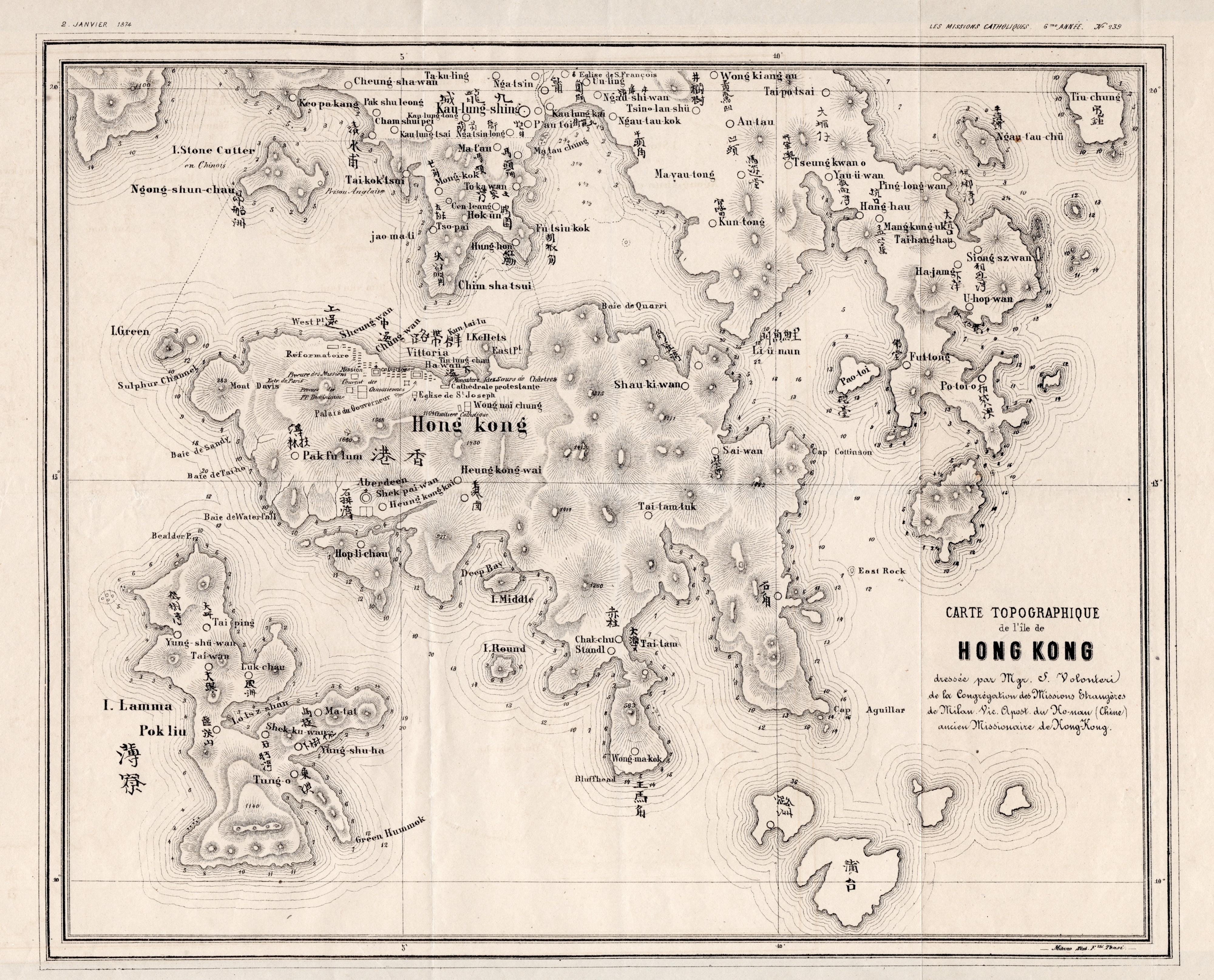
Carte Topographique de l'ile de Hong Kong dressee par Mgr. S. Volonteri de la Congregation des Missions Etrangeres de Milan [Plan of Hong Kong, map]
This uncommon lithographed map of Hong Kong, drawn by Monsignor Simeone Volonteri (1831–1904), represents a significant milestone in the cartographic history of the region. It is the first known bilingual map of Hong Kong, featuring place names in both Roman and Chinese scripts. The lithographic plate was prepared in 1873 in Milan and subsequently published in 1874 in Paris to accompany Volonteri’s article on the geography of Hong Kong in Les Missions Catholiques (Vol. VI).
This copy is sold together with the original issue of the journal, including the article (issue n°239). It includes a three-column article (p.10-11) describing the geography and recent history of the island, the British administration, and the “new city of Vittoria, with its sumptuous buildings, offering the British comfort of life, cleanliness, and luxury.”
Volonteri, an Italian missionary affiliated with the Roman Catholic Diocese of Hong Kong, spent a decade in the region from 1860 and was locally known as Padre Ho. His missionary work in remote parts of the San-On district, particularly around Sai Kung, prompted him to undertake extensive geographical surveys. These efforts resulted in two major maps: The Map of the San-On District (1866) and the present Carte Topographique de l'Île de Hong-Kong (1874), the latter being a revised and more focused depiction of the island and its immediate surroundings.
The level of detail in the map is remarkable, especially given the rugged terrain and the limited cartographic tools available at the time. It remained the most authoritative representation of the region for more than three decades and was used by British colonial authorities until the Survey of Hong Kong and the New Territories in 1901. The map clearly delineates the extended boundary of the colony following the 1860 incorporation of the Kowloon Peninsula.
Notable features in this edition include the addition of the Church of St. Francis (Église de S. François) and the English Prison (Prison Anglaise) on Ngong Shuen Chau (Stonecutters Island). The map also identifies the locations of buildings associated with religious congregations still present in Hong Kong today, including the monastery of the Sisters of St. Paul de Chartres and the convent of the Canossian Sisters (founders of Canossa Hospital), as well as St. Joseph’s Church, established just six years before the map was drawn.
Celebrated for its precision and scholarly value, the map received several awards at European exhibitions, including the Milan Cartographic Exhibition of 1894.
Though not entirely unknown, this 1874 edition is scarce and rarely recorded in institutional holdings. Its rediscovery was first noted in the 1973 article “Another Volontieri Map?” published in the Journal of the Hong Kong Branch of the Royal Asiatic Society, which identified it as a distinct and later production separate from Volonteri’s earlier map of San-On.
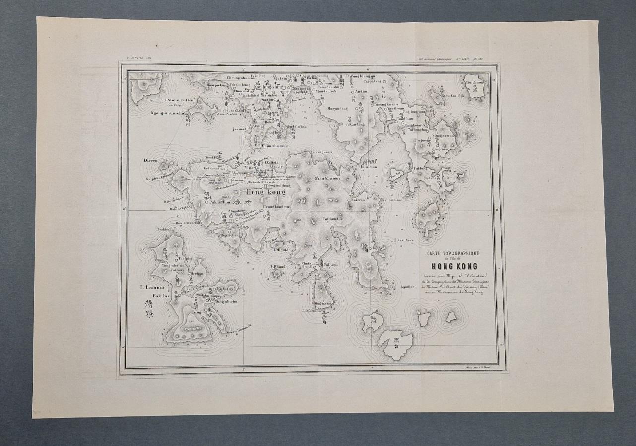
Wide margins; old folds as issued; an excellent copy. Sold with the (complete) issue n° 239 of Les Missions Catholiques, dated 2 Janvier 1874.