| Referencia: | 4207 |
| Año: | 1809 |
| Lugar de edición: | Madrid |
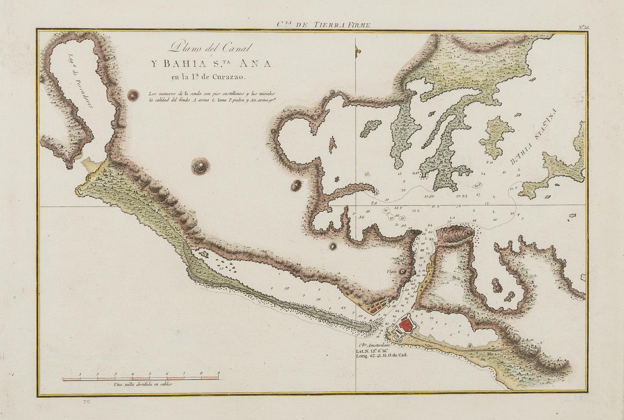
Plano del Canal y Bahia S.ta Ana en la Ia. de Curazao [Plan, map and chart of Curaçao]
Rare Spanish chart of Sint Anna Bay, Curaçao, featuring Willemstad and Fort Amsterdam with its fortifications. The coastline is depicted in great detail, including soundings, sandbanks, and the lighthouse ("vigía"). This chart was created by Joaquín Fidalgo during his renowned expedition to map the northern coast of South America, from Trinidad to Costa Rica. He visited Curaçao in 1794 and discovered a wealth of existing surveys, enabling the Spanish Navy to produce the most detailed charts of the Dutch island to date. The present map was published in 1809, during the French invasion of Spain, which significantly limited its distribution both within and outside the Iberian Peninsula. Old colors. Excellent general condition. Full title: 'Plano del Canal y Bahía Santa Ana, en la Isla de Curazao. Costa de Tierra Firme. Carta de la Expedición Hidrográfica del Atlas de la América Septentrional (1793-1804).
Sin Encuadernar - No binding
Very Good, Muy bueno.